Another post in our series to mark Scotland’s Years of Coasts and Waters 2020 – 2021.
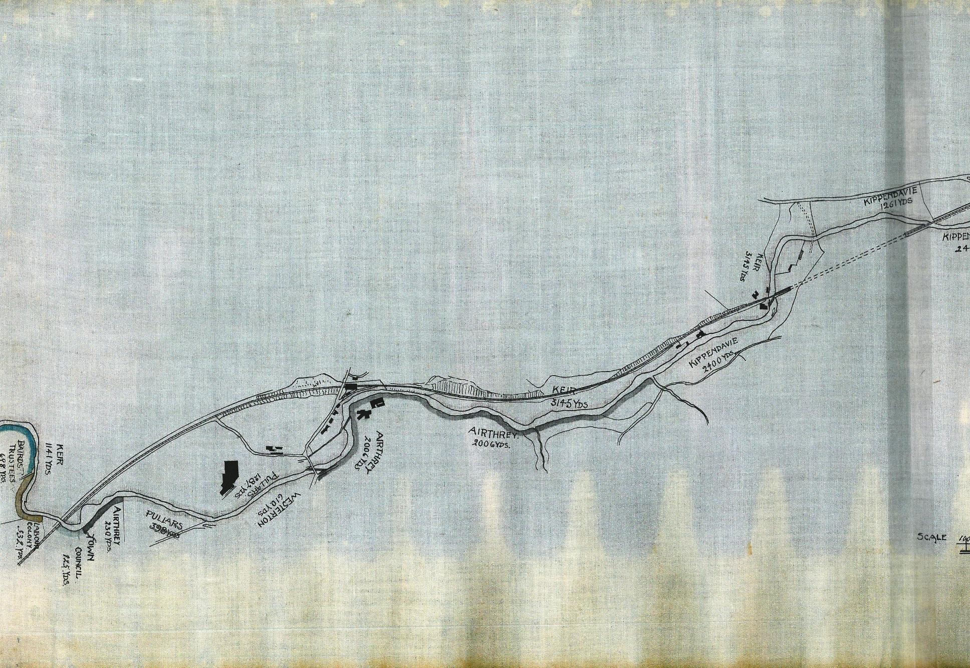
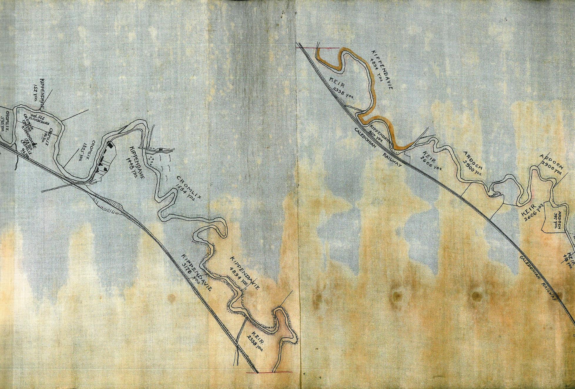
This lovely plan is held at the Archives as part of the Perthshire County collection of maps and plans. It shows the fishing rights of landowners around Dunblane who had properties that lay on the riverside. The plan is very long and thin, so it has been copied in sections.
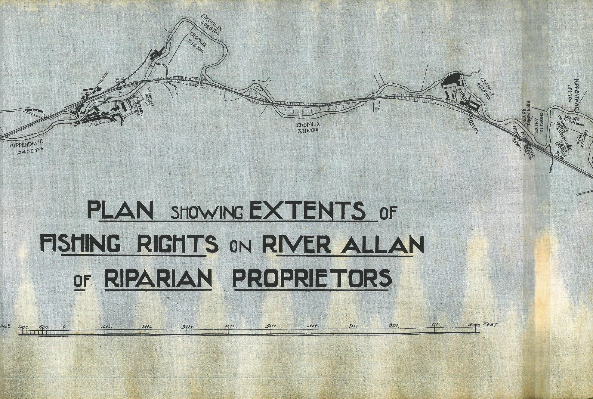
Each section of the riverside allocated to a particular landowner was known as a ‘beat’. You can clearly see the outline of the town of Dunblane as well as the names of all the estates that were situated along the river. Salmon and trout fishing rights are very valuable as a source of revenue through the grant of fishing licences, therefore it was very important to establish where the boundaries to the different ‘beats’ lay.
Inevitably, there were disputes between landowners in the Forthside area over fishing rights and in 1581, in an attempt to deal with these, the Scottish Parliament gave the Stirling Burgh powers to regulate the fishings via a new body called The Fisher Court, a body that lasted from this date until it was in its turn superseded by British Parliamentary legislation of the 18th and 19th century.
The Archives holds a collection of records relating to the administration of fishing rights and there are references to this in the Council minutes from the 16th century onwards.
Fishing for trout and salmon is still regulated by Stirling Council on the Allan Water and other rivers and waterways in the Council area.