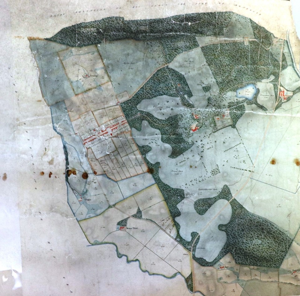
This post concentrates on the village of Gartmore now in the Stirling Council area but formerly in Perthshire. The Archives holds two wonderful estate plans of the Gartmore Estate, owned initially by the Cunningham-Graham family and then latterly by the Cayzer family. The earliest plan, surveyed by James Richmond, shows the village of Gartmore as it was in 1776.
Gartmore Estate Plan 1776

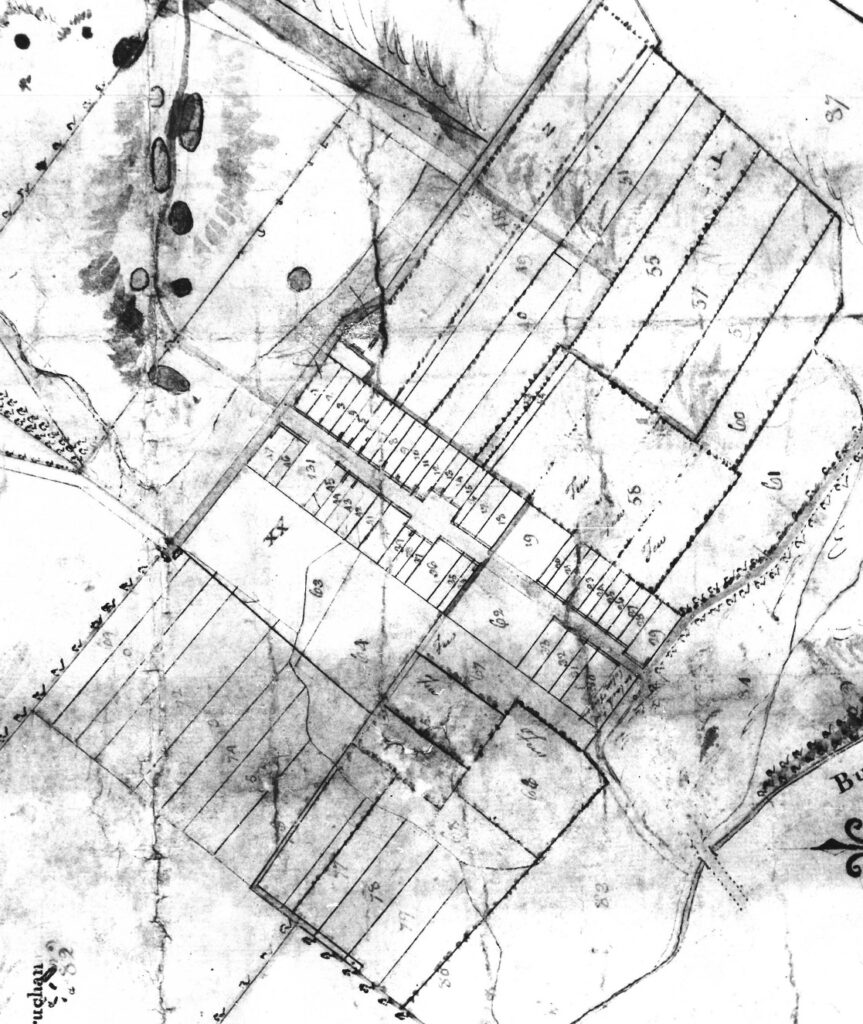
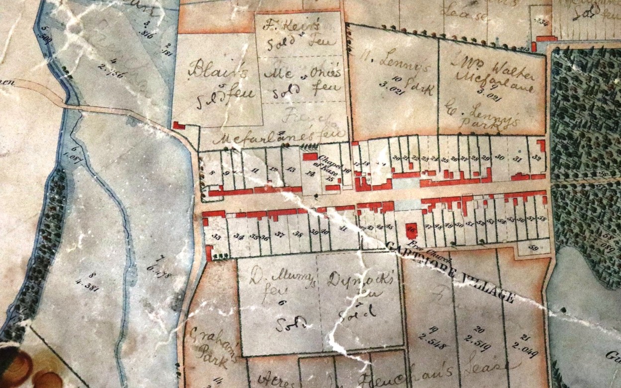
A later estate plan, surveyed by Charles Ross, shows the village as it was in 1853.
Gartmore Estate Plan 1853 
You can find out more about the Cunningham-Grahams and the Gartmore Estate in our previous blog post here.
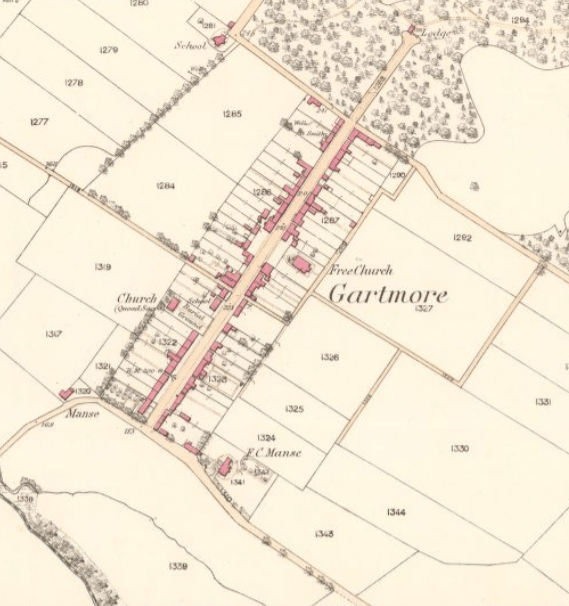
Ordnance Survey 1862 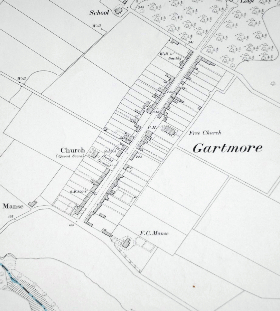
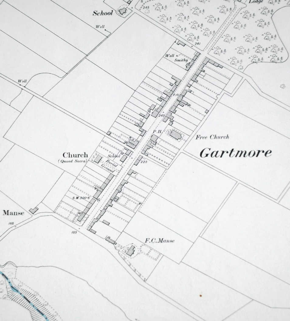
Ordnance Survey 1896 
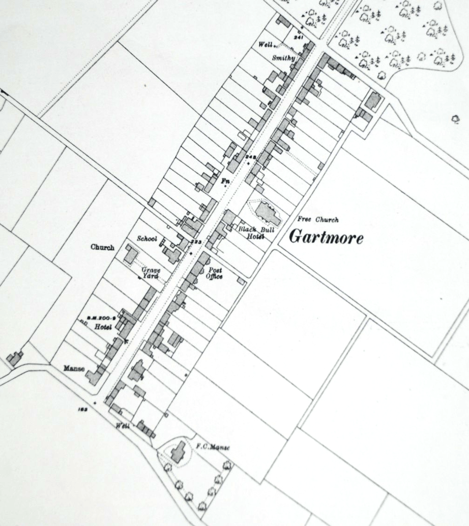
Ordnance Survey 1914
Free access to digitised images of maps for the whole of Scotland from the earliest times is available on the National Library of Scotland website here.
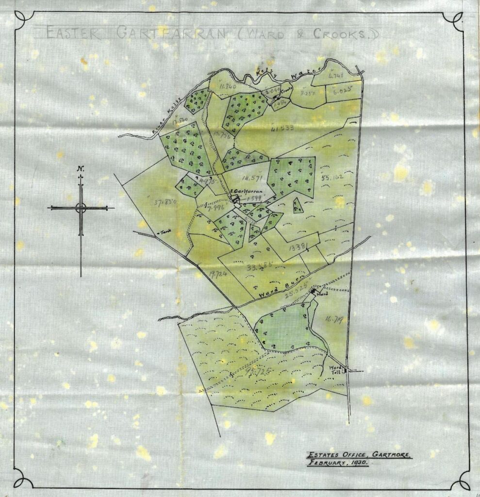
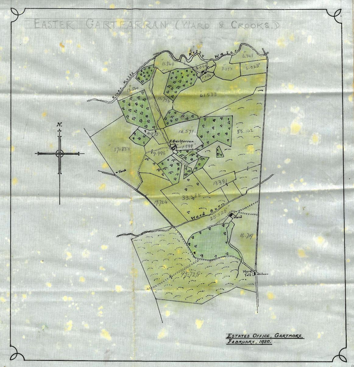
Easter Gartfarren estate plan 1930

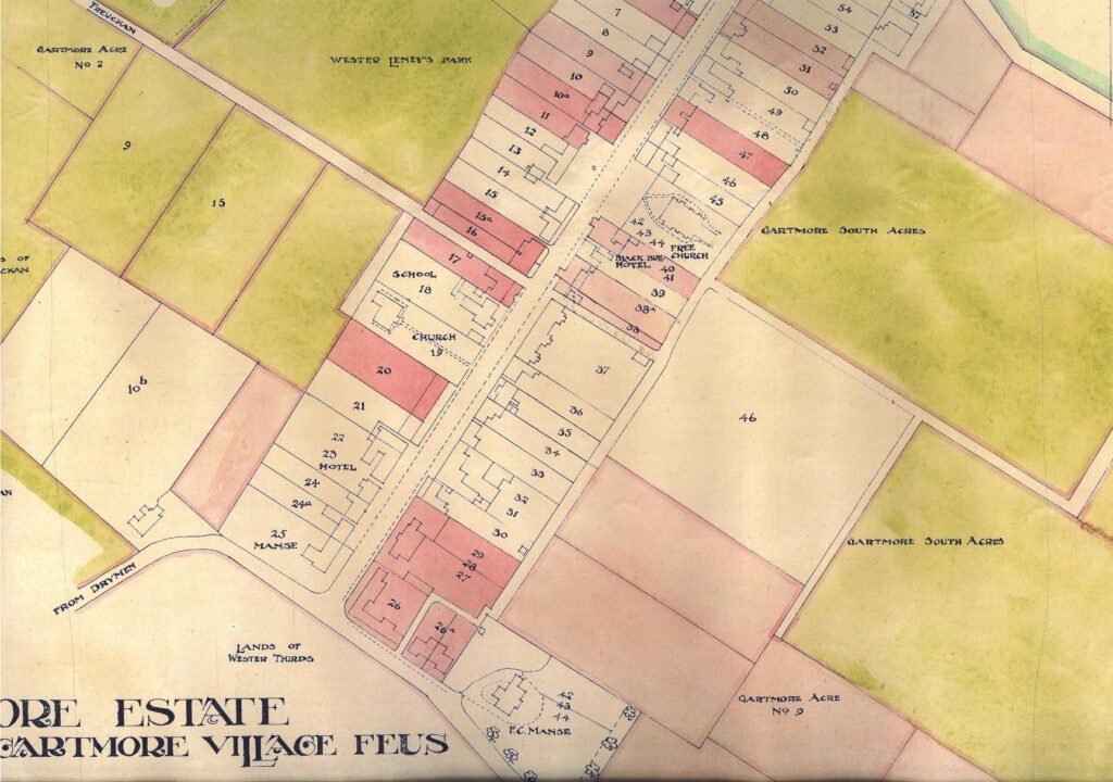
Gartmore feuing plan 1912

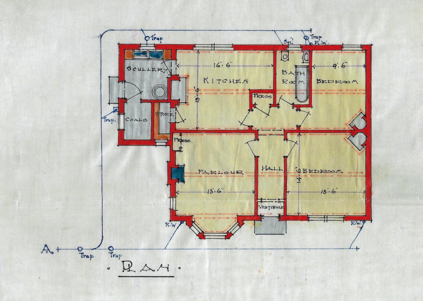
Finally, plans lodged with the local authority as part of applications for Planning and building consents give details of the original features of a property and its boundaries. The plan below is of Westerthirds Farm in the Gartmore Estate in 1925.
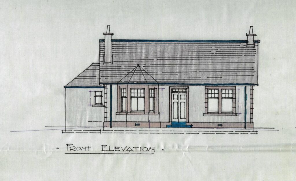
Plan of house at Westerthirds Farm, Gartmore, 1925